


Pix4D vs PX4: What’s the Difference?
As the drone industry rapidly expands across sectors like agriculture, surveying, construction, and defense, two widely recognized names—Pix4D and PX4—often appear in discussions about aerial mapping and autonomous flight control. While they may sound similar, Pix4D and PX4 serve entirely different purposes in the drone ecosystem. This article clarifies their functions, compares Pix4D to key competitors, and explains where PX4 fits in.
What Does Pix4D Do?
Pix4D is a Swiss company renowned for its professional photogrammetry and remote sensing software. Pix4D is a leading photogrammetry software suite. Its core function is transforming overlapping 2D images (typically captured by drones, but also aircraft, ground vehicles, or handheld cameras) into highly accurate 3D models, point clouds, orthomosaics (georectified maps), digital surface models (DSMs), and digital terrain models (DTMs).
●How it Works: Using complex algorithms based on Structure-from-Motion (SfM) and Multi-View Stereo (MVS), Pix4D identifies common points across multiple images, calculates camera positions, and reconstructs the scene's geometry and texture in 3D.
●Key Applications: Surveying & Mapping, Agriculture (crop health analysis, yield estimation), Construction (site progress monitoring, volume calculations), Mining (stockpile volumetrics), Infrastructure Inspection (power lines, pipelines), Environmental Monitoring, Urban Planning, and more.
●Product Range: Includes desktop applications (Pix4Dmapper, Pix4Dsurvey), cloud processing (Pix4Dcloud), specialized tools (Pix4Dfields for agriculture, Pix4Dscan for mobile/LiDAR), and capture apps (Pix4Dcatch).
Can Pix4D process LiDAR?
Pix4D's primary strength is photogrammetry (using images). However, some of its products can integrate and process LiDAR data. For example, PIX4Dsurvey is specifically designed to bridge the gap between photogrammetry and CAD by allowing users to import and work with point clouds from both LiDAR and photogrammetry, vectorizing features and preparing data for engineering software. It doesn't process raw LiDAR data in the same way a dedicated LiDAR software would, but it excels at fusing LiDAR point clouds with photogrammetric outputs. Pix4Dmapper can import and further process point clouds generated by external LiDAR systems, allowing users to generate DSMs, orthomosaics, and other outputs from imported data.
Which Is Better: Pix4D or DroneDeploy?
Choosing between Pix4D and DroneDeploy depends on your project requirements, budget, and technical expertise. Both are leading photogrammetry software platforms, but they cater to slightly different needs.
| Feature | Pix4D | DroneDeploy |
| Processing | Desktop-focused (PIX4Dmapper/matic) with cloud options. | Cloud-native. Processing happens entirely online. |
| Customization | High (Scripting, parameters) | Lower (Standardized workflows) |
| Usability | Steeper learning curve | User-friendly, fast onboarding |
| Pricing | License-based (desktop) + Cloud credits | Subscription (cloud-centric) |
| Core Strength | Advanced Processing & Flexibility | Integrated Cloud Workflow & Ease of Use |
| Best For | Surveying and mapping professionals who need maximum accuracy, control, and detailed outputs. | Businesses prioritizing speed, automation, collaboration, and ease of use across teams. |
What is the difference between Pix4D and Agisoft Metashape?
Pix4D and Agisoft Metashape are direct competitors and two of the most powerful desktop photogrammetry solutions available. The choice often comes down to user preference and specific project requirements.
●User Interface (UI): Pix4D is often considered more intuitive and user-friendly, guiding users through a more structured workflow. Metashape offers immense flexibility but can have a steeper learning curve due to its less-structured UI.
●Processing Algorithms: Both produce excellent results, but their underlying algorithms differ slightly. In some comparisons, Metashape may have a slight edge in reconstructing fine details on complex structures, while Pix4D is praised for its reliability and robust generation of DSMs and orthomosaics.
●Output Quality: Produces highly detailed meshes and point clouds, especially for thin or intricate objects.
●Processing Speed: Historically, Metashape was often faster, especially with GPU acceleration. However, Pix4D has made significant strides with products like PIX4Dmatic, which is optimized for very large datasets and is exceptionally fast.
●Pricing: Both offer perpetual licenses and are similarly priced in the professional tier, representing a significant investment.
●Support: Pix4D offers superior customer support; Metashape relies on community forums for troubleshooting.

DroneDeploy vs Pix4D vs Agisoft Metashape: Which One Should I Choose?
Choosing between DroneDeploy, Pix4D, and Agisoft Metashape depends on your project goals, budget, and technical requirements:
●For Simplicity & Cloud-First Workflow: DroneDeploy is the clear winner if you prioritize ease of use, rapid field-to-share workflow, and cloud collaboration, and don't need the deepest desktop processing.Ideal for terrain mapping and quick turnarounds but limited by cloud dependency and weaker terrestrial mapping.
●For Advanced Control, Surveying & LiDAR Integration: Pix4D (especially Pix4Dmapper/Pix4Dsurvey) excels when you need the highest level of control, robust tools for surveying professionals, strong LiDAR processing, or use specialized modules like Pix4Dfields.
●For Maximum Customization & Granular Control: Agisoft Metashape is ideal for researchers, technical experts, and users who need extensive parameter tuning, scripting via Python, and potentially slightly lower cost for comparable core photogrammetry power.
What Is PX4?
PX4 is the software that runs on a drone's flight controller hardware (e.g., a Pixhawk). It interprets sensor data from the IMU (accelerometer, gyroscope), GPS, and barometer to understand its position and orientation in the air. It then controls the motors to keep the drone stable, fly to waypoints, or respond to pilot commands.It governs how drones fly, providing low-level control over:
●Autopilot algorithms (attitude, position, velocity)
●Sensor fusion (IMU, GPS, barometer, etc.)
●Failsafes and geofencing
●Flight modes (Manual, Stabilized, Mission, RTL, etc.)
Key characteristics of PX4 include:
● Open-Source: The code is freely available for anyone to view, use, and modify. This fosters rapid innovation and customization.
●Modular Architecture: It has a highly flexible design, making it easier for developers and researchers to add new features or adapt it for novel vehicle types (like VTOLs or rovers).
●Permissive Licensing (BSD): Its license is business-friendly, allowing companies to integrate PX4 into their commercial products without being required to share their proprietary modifications.
●Ecosystem: It's tightly integrated with the MAVLink communication protocol and QGroundControl ground station software.
What is the Difference Between PX4 and ArduPilot?
PX4 and ArduPilot are the two dominant open-source autopilot platforms. Both are highly capable, but have different philosophies and strengths:
| Feature | PX4 | ArduPilot |
| Origin/Structure | Newer codebase, designed with modularity (uORB middleware) | Older, more established codebase, historically more monolithic |
| Flight Controllers | Pixhawk, Holybro, CUAV | Pixhawk, CubePilot, Matek, many others |
| Focus | Efficiency, real-time performance, broad vehicle support | Extensive feature set, long mission endurance, proven stability |
| Ecosystem | Tight integration with Dronecode hardware (Pixhawk standards), QGroundControl | Broad hardware support (many Pixhawk variants), Mission Planner / QGC |
| Ease of Use | Generally considered slightly easier for new developers due to modularity | Large community knowledge base |
| Best For | Researchers, developers, and companies building custom drones or integrating advanced payloads due to its flexibility. | A vast range of hobbyist, commercial, and traditional vehicle types (planes, rovers, boats, subs) due to its mature, feature-rich, and stable codebase. |
Pix4D vs PX4: What’s the Difference?
The difference between Pix4D and PX4 is simple and absolute: they exist in completely different parts of a drone operation.
●Pix4D is Photogrammetry & Mapping Software: Runs on your computer or in the cloud. It's an application (desktop or cloud) you use after a flight to process captured images and sensor data into maps, models, and measurements. It's about data analysis and output.
●PX4 is Flight Control Software: Runs on the drone. It's the operating system running on the drone itself during the flight. It controls the drone's physical movement, stability, navigation, and mission execution. It's about autonomy and control.
Think of it like this:
They are Complementary: PX4 is the pilot, and Pix4D is the cartographer who analyzes the pilot's survey data back in the office. You need both—or equivalents of both—for a complete drone mapping workflow. They are not alternatives to each other. A drone using the PX4 autopilot can easily capture images that are then processed using Pix4D software to create the final deliverables. They operate at entirely different stages of the drone workflow.
Conclusion
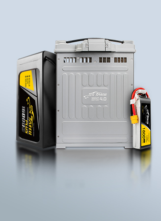
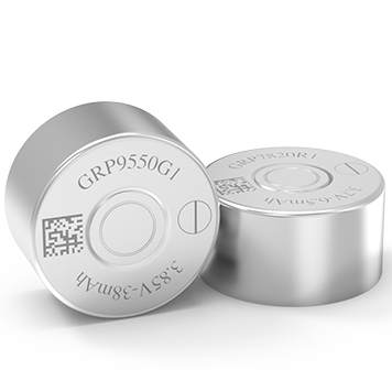
In summary, Pix4D is about data processing and analysis—what to do with images once captured. PX4 is about autonomous vehicle control—how to fly, navigate, and gather those images in the first place. They serve different but often complementary roles in drone workflows. Professionals often use PX4 to operate and automate their drones, then process the collected data with Pix4D or similar software, choosing complementary solutions based on their domain, scale, and technical needs. As a world-leading manufacturer of drone batteries, Grepow provides high-power and high-energy-density batteries that are fully compatible with premier flight control systems like PX4 and ArduPilot. In particular, their semi-solid state batteries, which achieve an energy density of up to 350 Wh/kg, are an ideal choice for surveying and mapping drones. If you have any questions or needs, please feel free to contact us at info@grepow.com.


Related Articles
-
Powering Aerial Artistry: Grepow Battery Solutions Behind Drone Light Shows
2025-10-27 -
Vatican Drone Show: Where Technology Meets Faith
2025-09-15 -
Why Do We Need Silent Drones?
2025-09-02
Related products
-
330Wh/kg Series Semi-Solid State High Energy Density Battery Pack
-
350Wh/kg Series Semi-Solid State High Energy Density Battery Pack
-
4.45V Ultra High Voltage Series Semi-Solid State Battery
Comment(0)
Comment( Your email address will not be disclosed. Required fields are marked as * )